


jollyjacktar
-
Posts
67 -
Joined
-
Last visited
Content Type
Profiles
Forums
Events
Gallery
Posts posted by jollyjacktar
-
-
Ok, so I've been reproducing some of the charts from John Sellers The English Pilot recently and have a one-off that hopefully you may want.
So this is not a hand drawn chart. It is a scan and print of a hand drawn chart of the James and York Rivers.
I hand plotted, sketched and inked the original one (see the comparison picture) When I went to see how a print would look, it would only print at 11 1/2 "x14 1/2" (not the orginal 16"x19") It is printed on laid linen paper and is finished with watercolors.
I don't intend to do any more prints of this one, and since I have the original I'm offering this one out.
$35 + actual shipping costsPlease Email me at cranohlandt@gmail.com if you would like this map
Thanks for looking and if you have any question please ask.
Yours & co
Cran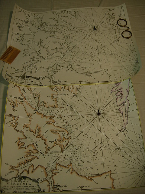
Original&Copy by Cran Ohlandt, on Flickr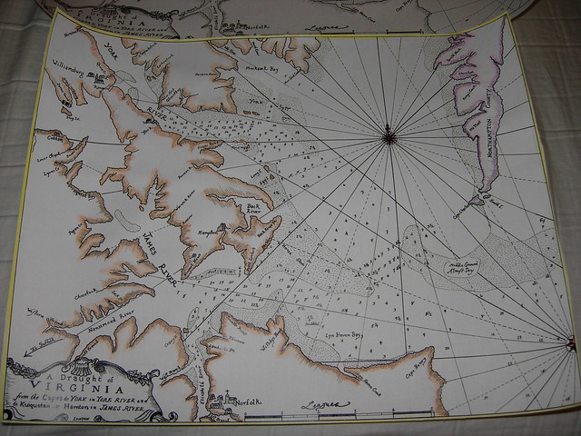
fullcoloredmap by Cran Ohlandt, on Flickr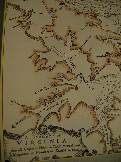
ColoredDetail by Cran Ohlandt, on Flickr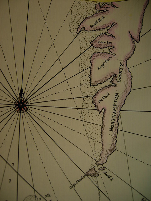
Northhamptoncounty by Cran Ohlandt, on Flickr -
Sold! thanks everyone for looking
-
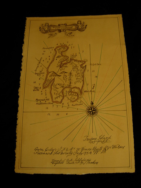
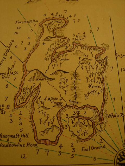
Hey Guys!
I hope everyone here is well, and having a wonderful season.
I've got a map that I drew here that is looking for a home (It was a commission that I finished but never heard back from the guy who wanted it) So now it's your chance to please a pirate on your christmas list (even if that's yourself)
About the map
It's a completley hand drawn reproduction of the map in the front of Robert Louis Stevenson's Treasure Island. It's approximately 9" x 14" on very heavy laid cotton paper that I stained with coffee.
$25 plus shipping and I'll ship it out this weekend if anyone is interested. Thanks for looking!
either message me here on the Pub or email me at cranohlandt@gmail.com
Yours & co
Cran
DSCN3642 by Cran Ohlandt, on Flickr
DSCN3647 by Cran Ohlandt, on Flickr
-
I'll throw in some of mine if they pass muster

Here's a photo of me on my wedding day, in a suit based on the jacket found on the Royal Kronan

1670's milita

Me in my typical seaman's outfit
-
First of all I'd like to thank everybody for their interest, and their generosity as the map has sold for $150. I know Adam will be greatly appreciative.
Yours & co
Cran
-
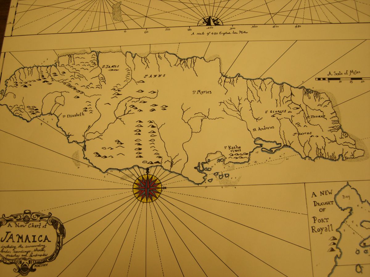
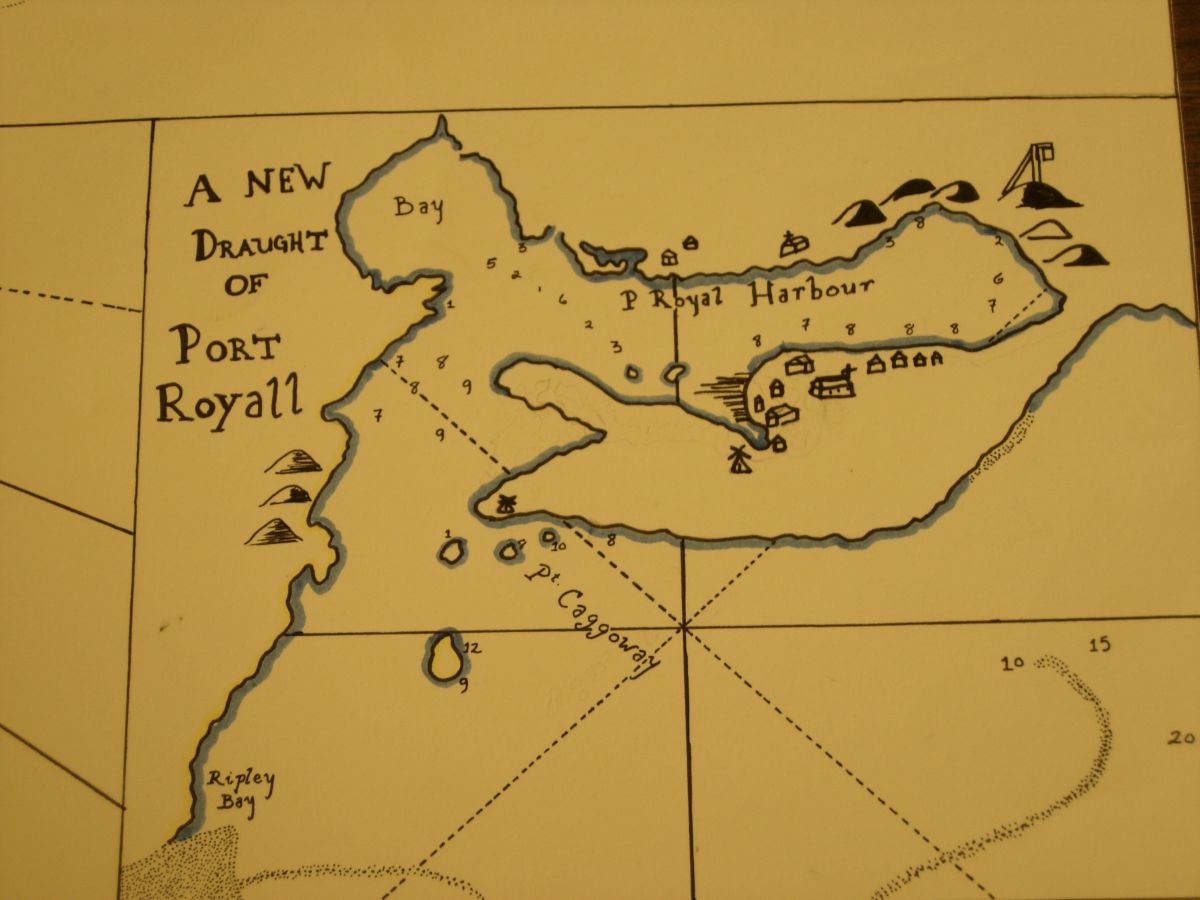
Hello everyone,
As some of you may know our brother Adam Cyphers is in need of some cash, and has been selling off a lot of his kit. I'd prefer not to see this happen to one of my favorite sailor/ blacksmith/people in the living history community.
I don't have the cash to buy any of his stuff, but I do have a map I'm willing to part with
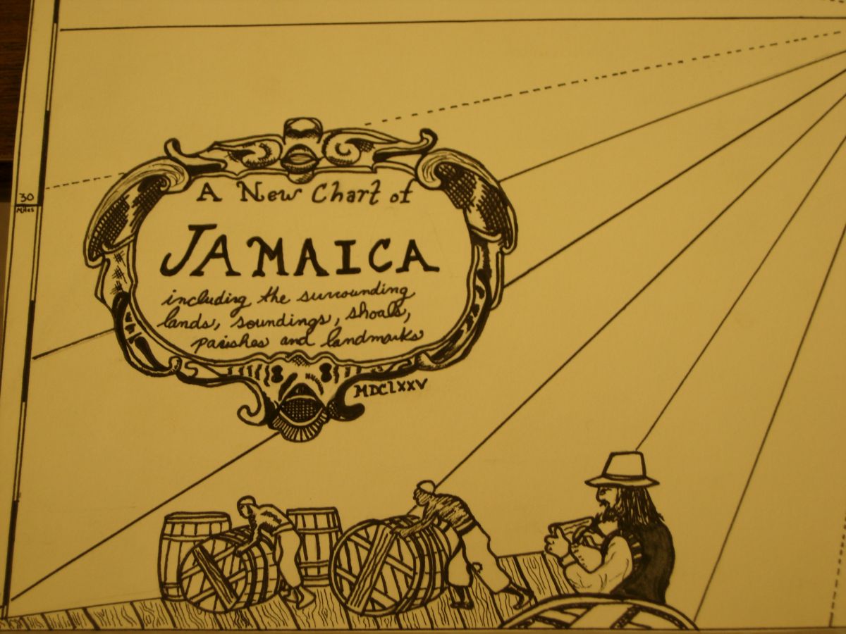
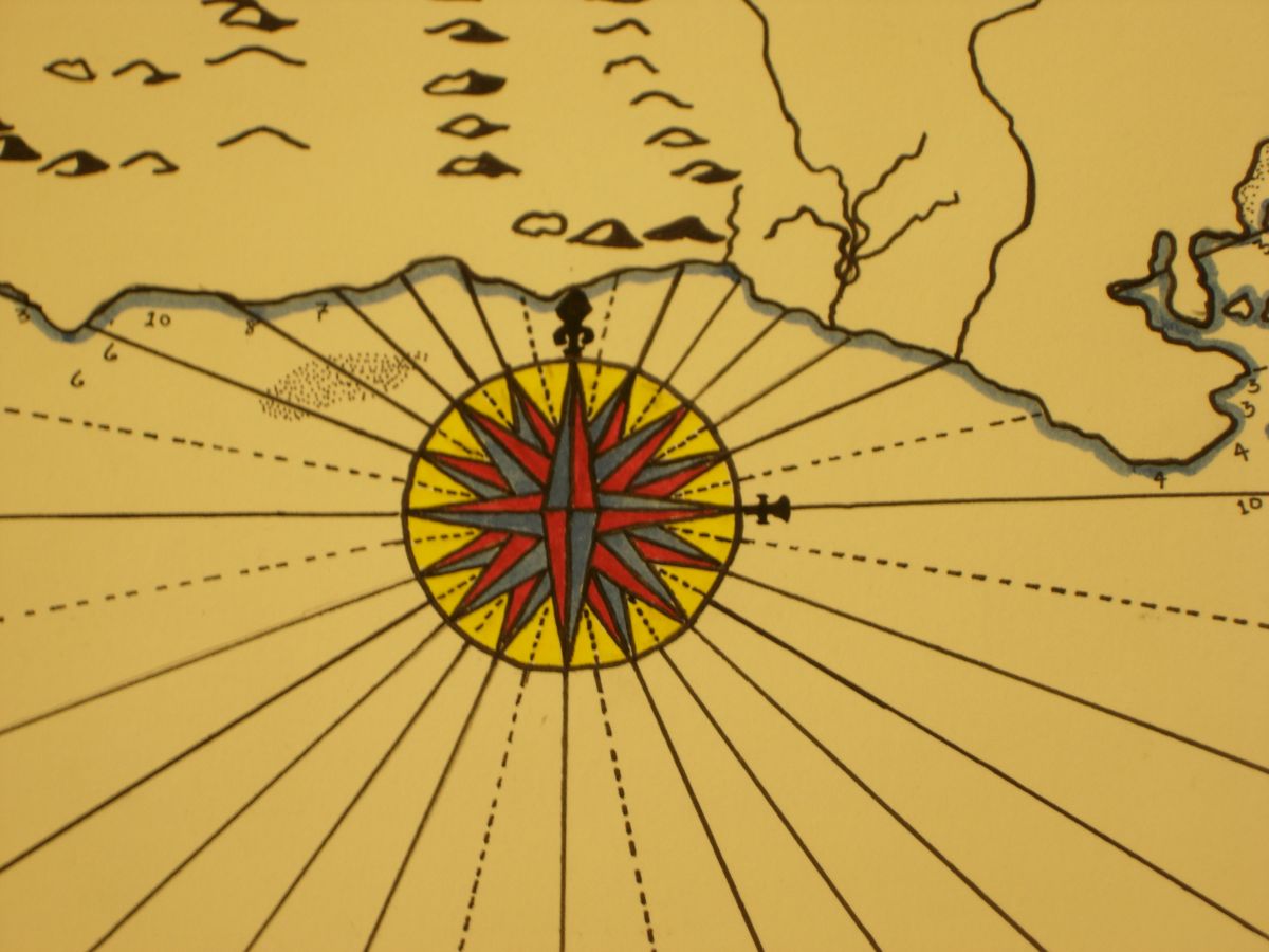
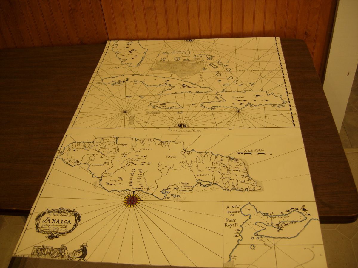
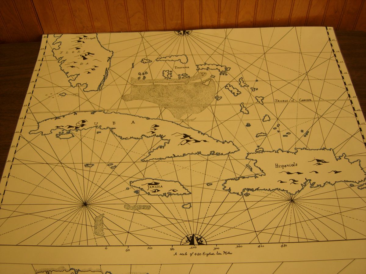
It’s hand plotted, sketched, then inked, on cotton laid paper.
The overall map is 34 ½” tall and 24 ½” inches wide.
The top half of the map covers from the 30 degrees latitude (central Florida) to 15 degrees (South of Jamaica) It even includes soundings around Key West :-)
The lower half of the map is an enlarged map of the island of Jamaica including an inset of Port Royal Harbour, again including soundings and shoals as well as a decorative cartouche in the lower left of the map.
I'm not going to put a price on this but I promise that I'll cover the shipping to you so that everything you pay for the map will go directly to Adam.
Feel free to ask questions and I can't wait to help Adam out.
Yours & co
Cran
-
I've never actually sold one
I'll make a quote based mostly on size, detail, and amount of text. but I imagine they'd be somewhere between $75 and $100 dollars which would include the high resolution digital scan.
Were you looking at a certain geographic area?
-
Hello everyone.
I should preface this post by saying that I've never sold any of my maps and that I'm still unsure as to how much they may be worth to someone.
But.... I'm in need of some 19th century kit in order to work at a historic site here near Seattle and was told by a fellow reenactor I should try to sell my maps in order to make that possible.
So what will you get?
A map. On linen paper, Hand plotted, drawn, inked and colored(if you so desire) Every map I've made so far has been very closely based on an original I've found somewhere. I promise you the closest to a period map that I am able to make. I have been using modern inks so that the drawing and lettering is as waterfast as I can (I know you'll probably take these to an event or two. and we all know the weather can be unpredictable)
I also promise that I won't sell your map to anyone else. I may make a copy for myself but you will have this hand drawn map all to yourself. I'll also send you a digital scan that you can use to print another in the unfortunate case yours gets destroyed beyond use.
You can see some of my maps in this facebook albumn. If you have any questions or would like to see other pictures please don't hesitate to message me or ask in the comments.
http://www.facebook....=3&l=b9559d342c
Thanks again for your consideration,
Yours & co
Cran
-
http://www.shipbrook.net/jeff/seamansgrammar/SeamansGrammar.pdf
From John Smith's Seamans Grammar we get his interpretation of the difference between line and rope.
Chapter VI
What doth belong to the Boats and Skiffe with the defintion of all those Thirteen Ropes which are only properly called ropes belonging to a ship and the boat and their use.
The thirteen ropes are: Entering Rope, Bucket Rope, Bolt Rope, Port Rope Jeare Rope, Preventer rope, Top rope, Keel rope, Rudder rope, Cat rope, Boy Rope, Boat rope, Chest Rope.
You can find all the definitions by following the link to a PDF of the book.
Yours & co
-
HeyBo,
I was the one who sent you that drawing and keychain. I'm sorry about my avatar name and my real name not lining up easily.
Happy Christmas
-
Well one person whose gifts arrived very much on time (actually back in November) was POD. As with all of his work I got some really awesome stuff most notably a cast pipe tamp and some tobacco papers ( I was secretly considering ordering these) All I can say Mr. Morrisroe is thank you very much. Yours was the first under our tree and I was able to restrain myself until yesterday to open it. Thanks again!
Yours & co
Mr. Ohlandt
-
So here's a little reproduction map that I've been working on for a couple of days. Certainly not the nicest one I've drawn but all in all I think it turned out well. It's 16"x21" on laid paper. The map is completey hand plotted, drawn, and inked with one of the main ou of period details being that I used pens with waterfast ink to prevent smudging should the map get wet. Comments and Crtisicm are welcome.
Thanks
Cran
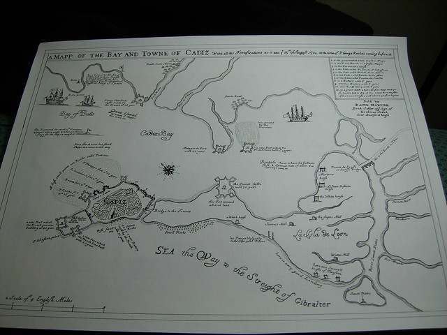
Map of the Bay of Cadiz by Cran Ohlandt, on Flickr
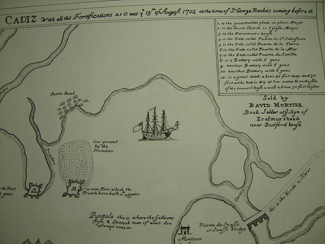
Right hand corner detail by Cran Ohlandt, on Flickr
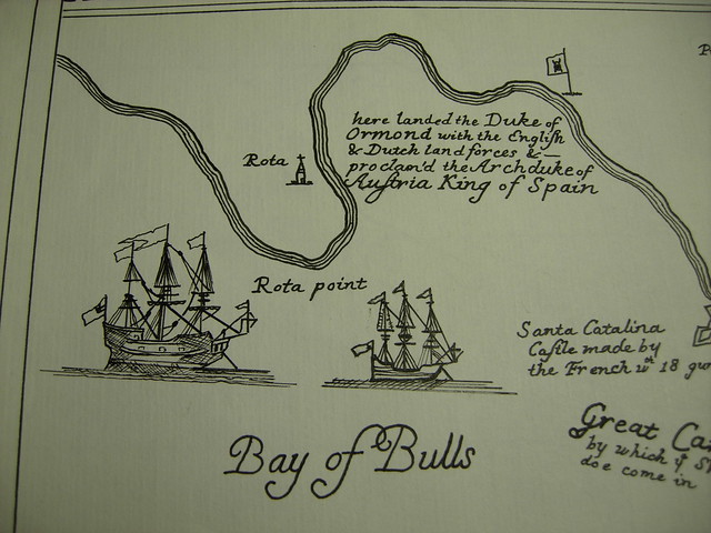
Detail Ships by Cran Ohlandt, on Flickr
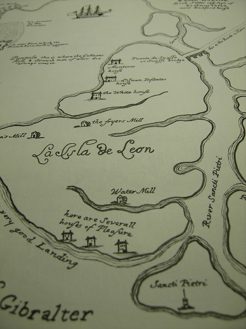
Houses of Pleasure by Cran Ohlandt, on Flickr
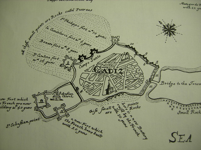
Cadiz detail by Cran Ohlandt, on Flickr
-
I finally got mine!
By no fault of Pews (I had to have mine forwarded from SC here to Seattle)
Exceptional work everyone. I'm going to post two photos here so people can see where the cards they recieved from me fit into the larger picture.
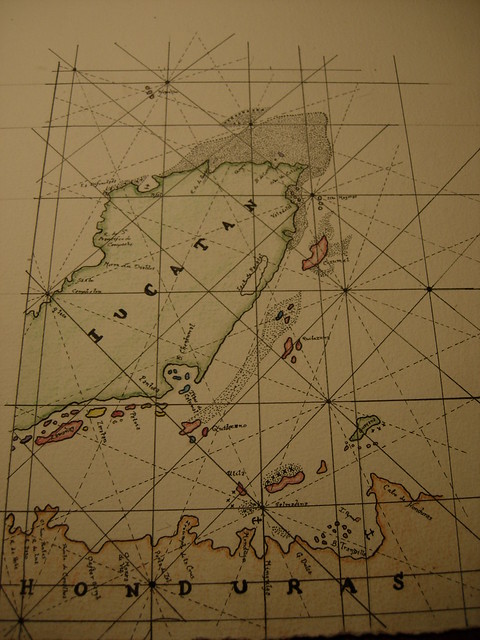
yucatan map whole by Cran Ohlandt, on Flickr
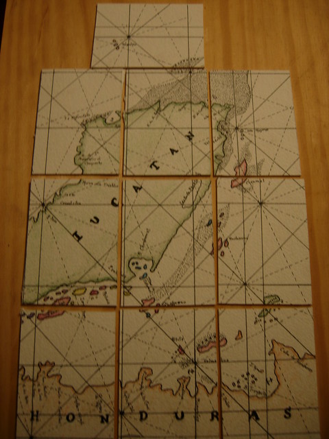
yucatan map divided by Cran Ohlandt, on Flickr
Yours & co
Cran
-
Could be interested, what are the rules/ guidelines?
-
Mine was a map of the Yucatan that had been cut into cards.
-
It was truly a pleasure to meet you at Hampton.
can't wait to see you posting again.
Yours & co
CJ
-
I've got to be quick, but I know that a number of staved drinking vessels were found on sailing ships from the 16th through 19th centuries.
Yours & co
-
You can count me in
-
Brethren,
The tides are changing and come late August Me, my wife and our cat will be packing up the HMS Chevrolet and moving from Charleston SC to Seattle. In an attempt to make the places we stay more interesting (who doesn't like pirates?) and a little cheaper I thought I would post the course we were looking at taking and seeing if there were any pirates along the way that would be willing to open there doors to a few sea worn souls.
Anyway the trip looks something like this.
Leg 1: Charleston to Cincinatti (Someone off board has already offered a place to stay there)
Leg 2: Cincinatti to Des Moines
Leg 3: DesMoines to Rapid City South Dakota
Leg 4: Rapid City to Butte Montanna
and the final leg is from Butte to Seattle.
We are tentatively planning on leaving Charleston on the 26 of August.
Any help or guidance anyone can lend on this given course would be much appreciated
Yours & Co
CJ
-
Hello!
Is there anyone coming from either SC or NC for this event? Thanks to recent circumstances I am in desperate need of help with transportation. Any help would be greatly appreciated
Yours & co
Mr. Ohlandt
-
That particular topsail is 15' across the head and nearly 28 along the foot. with around a 13' hoist.....
Hope that helps, I've had to handle that sail a few times and she's pretty fun.
Yours & co
-
I swear I was on my ship, my mess mates can vouch for me. Not to mention that stores across the Ashley River and I don't have a longboat
-
Happy Birthday good sir and I hope it is a truly enjoyable day.
Yours & co
Mr. Ohlandt
-


A picture of the whole kit laid out Interpretive style ( iknow the quality isn't great but the close ups are better)

Close up of the extra cloaths in the pack, cut or cloath hose, work frock, spare pair of woolen breeches, and thrum cap and blue linen neckcloth
Then a closeup of the afore-picture parcels, laid out on display


Closer shot of the bowl / The Far side of the hammock which includes my working gear


Close up of my rigging belt( Made by Hawkyns) my knife and marling nail, they are laid out on a proclamation for the gathering up of wandering sailors and sea-faring men
Close ups of my other working tools, sailmakers palm, fid, twines, needles, & seam rubber


All in all it's a great kit for representing a common seaman of the late 17th or early 18th century and at a whopping 14.1 pounds it's not to heavy to sling on your back
Yours & co
C. Ohlandt
Hand Colored Map of Virginia 1675
in Thieves Market
Posted
Sold Pending funds.