-
Posts
703 -
Joined
-
Last visited
Content Type
Profiles
Forums
Events
Gallery
Everything posted by PoD
-
From the album: My Creations
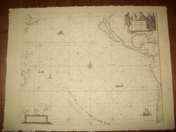
This is a replica of a 1675 English Seachart of the South Sea by John Seller hydrographer to the Kings most excellent majestie<br /><br />It is printed on period correct Linen and cotton rag laid paper.© © Letters of Marque
-
another excellent sword. I may be in the market for another of your fine products as my wife wants a sword now.
-
I'm actually thinking of replacing the hilt completely. I have a peice of antler that will look great on the grip and I think I may make a hunting hanger out of it now i have access to a plasma cutter.
-
I've been looking for this thread. Here's my flag
-
I'm not up on navigation but on the replica trade wind chart that I sell it seems the winds begin just below madeira rather than around the Azores. The chart does show a voyage line that goes from spain through the Azores to the colonies somewhere around Cape May but it doesnt seem to touch on the actual trade winds.
-
I just bought a couple of buckles and bits off ebay with the hopes of reproducing them somehow or at least using them as the basis for some larger buckles. Elaborate 17th-18th Century Bronze Buckle Queen Anne Period Bronze Buckle 1710 17th-18th century cupid type bronze belt hanger Attractive 17th century bronze open-work fitment
-
There's a rumour that they are shooting at least some of the new film in St Ives in Cornwall over here in the UK. Don't know how true that is.
-

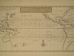
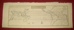
Replica 1715 view of ye general and coasting trade-winds, monsoons or
PoD replied to PoD's topic in Thieves Market
This particular chart shows the directions of the winds for the whole year rather than being seasonal. There are areas that have the months of the year next to the corresponding direction arrows. -
This is a replica of a 1715 chart of A view of ye general and coasting trade-winds, monsoons or ye shifting trade winds through ye world, variations & c. According to the newest and most exact observations, by H. Moll geographer. This map was compiled with information collected on the voyages of William Dampier. It is printed on period correct Linen and cotton rag laid paper and is about 8" x 21" (the correct size of the original) $25
-
From the album: My Creations
This is a replica of a 1715 chart of A view of ye general and coasting trade-winds, monsoons or ye shifting trade winds through ye world, variations & c. According to the newest and most exact observations, by H. Moll geographer. <br /><br />This map was compiled with information collected on the voyages of William Dampier.<br /><br />It is printed on period correct Linen and cotton rag laid paper and is about 8" x 21" (the correct size of the original)© © Letters of Marque
-
I have to admit I agree. I read it and its just all been done before. It seemed like a re-hash of Pirates of the Caribbean for the most part. The strangest part I thought was the fact he builds up this great bad guy then seems to kill him off way to easily halfway through the book. Wasn't impressed. They seriously need to bulk the story out to get a half decent movie out of it.
-
Looks like that particular cat is sold but I'm putting another one together within the next day or two. Different style but just as effective. Just got that Cat this morning and its awsome. The quality of the rope work is top notch. It should however not be used to try and threaten your wife into making dinner as it doesn't stop flying plates
-
I'll probably get another batch up next week. My eyes are burnt out from fixing the images at the moment.
-
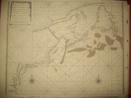
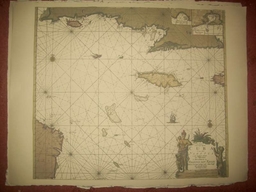
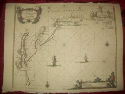
Ok i have new charts up. Another 17th century one and 2 charts now which are from the early 18th Century: Replica 1666 Dutch Seachart of the Atlantic coast of America from Cape Cod to Cape Hatteras Replica 1712 Dutch Seachart of the Antilles, Greater, Cuba, and Jamaica Replica 1713 English Seachart of of New Foundland, New Scotland, New England, New York, New Jersey, with Virginia and Maryland They can be seen in the thieves market thread here
- 39 replies
-
- navigation
- documents
-
(and 2 more)
Tagged with:
-
Here's another 2 charts. These are from the early 18th Century: Replica 1712 Dutch Seachart of the Antilles, Greater, Cuba, and Jamaica Replica 1713 English Seachart of of New Foundland, New Scotland, New England, New York, New Jersey, with Virginia and Maryland
-
From the album: My Creations
This is a replica of a 1713 English Seachart of of New Foundland, New Scotland, New England, New York, New Jersey, with Virginia and Maryland<br /><br />It is printed on period correct Linen and cotton rag laid paper.© © Letters of Marque
-

Replica 1712 Dutch Seachart of the Antilles, Greater, Cuba, and Jamaica
PoD posted a gallery image in Pub Members Gallery
From the album: My Creations
This is a replica of a 1712 Dutch seachart showing the Antilles, Greater, Cuba, and Jamaica islands.<br /><br />It is printed on period correct Linen and cotton rag laid paper.© © Letters of Marque
-
I have added another Chart now. It's a 1666 Dutch Seachart of the Atlantic coast of America from Cape Cod to Cape Hatteras.
-
From the album: My Creations
This is a replica of a 1666 Dutch seachart showing the Atlantic coast of America from Cape Cod to Cape Hatteras. The emphasis is on the Dutch colony of New Netherland. New Amsterdam (New York) is shown at the tip of Manhattan Island. Many other Dutch place names appear, including Staten Eylandt, Lange Eylandt, and Vlysingen (Flushing). Along the Delaware River a number of Dutch settlements are shown, including Fort Casimir, Nassau and Elsenburgh, as well as the Swedish Fort Christina. The Schuylkill River, future site of Philadelphia, is also shown.In New England, Martha's Vineyard and Nantucket are shown with their present names, and several early English settlements, such as New Plymouth are located. Excellent early delineation of the Chesapeake Bay, with Jamestown located. The Potomac River is shown as the Patwomeck.<br /><br />It is printed on period correct Linen and cotton rag laid paper.© © Letters of Marque
-
Actually I was just thinking I bet you could make a set out of some wood nails with a dremel and a blow torch. I shall investigate it when I go to my dads workshop.
-
when I was looking at the picture I assumed they were a lot bigger than they actually are. They are only the length of a tooth pic. I was considering making some but I dont think I can work that small.
-
This page has a few items that may well look good in a medicine chest. I particularly like the early 18th century bullet extractor and the personal dental kit. http://www.etesseract.com/Medical/Medical.html
-
Would buccaneers have carried snares or was their hunting limited to the gun?
-
I'll look out for them. I dont think any of mine are by him though. I think his maps seem to be slightly before the GOAP so thats probably why I havent come across him.


